Page 2 of 40 FirstFirst 12345612 ... LastLast
Results 21 to 40 of 789

Thread: Weather Thread

  1. #21
    Expatriate American Patriot's Avatar
    Join Date
    Jul 2005
    Location
    A Banana Republic, Central America
    Posts
    48,612
    Thanks
    82
    Thanked 28 Times in 28 Posts

    Default Re: Weather Thread

    If you're not getting a LOT of water, you can get a boat bilge pump. They do the same thing.

    But if your house is filling up rapidly, that's not going to help.

    I have a small bilge pump I keep with some hose and a solar panel. I used it to finish draining the hot tub recently when I couldn't get all the water out of the bottom through the normal drains. Worked well. In fact, it probably could have drained the whole tub using a solar panel and the pump and a hose about an hour and a half LESS than letting it drain on it's own. Maybe even quicker.

  2. #22
    Super Moderator Malsua's Avatar
    Join Date
    Jul 2005
    Posts
    8,020
    Thanks
    2
    Thanked 19 Times in 18 Posts

    Default Re: Weather Thread

    Harbor freight also sells cheap 2" pump. http://www.harborfreight.com/2-clear...ine-69774.html

    I have a small pump that does 4 gallons a minute in my sump...it starts running when there is incidental water coming in. In the picture below, it is tied in at the junction off of the one pipe. It wasn't hooked up when I took that image.

    When the float level gets above that pump, the cast iron workhorse Zoeller 1/2HP 65 gallon per minute pump comes on.

    If that pump gets overrun, a chinese Simer 1/2 HP that does about 60 gallons per minute will kick in.


    I added that second pump after this following happened during a massive rain. The 65gpm pump was running flat out and this still came in. I've since landscaped and added drainage so it won't happen again.

    Last edited by Malsua; October 4th, 2013 at 14:28.
    "Far better it is to dare mighty things, to win glorious triumphs even though checkered by failure, than to rank with those poor spirits who neither enjoy nor suffer much because they live in the gray twilight that knows neither victory nor defeat."
    -- Theodore Roosevelt


  3. #23
    Expatriate American Patriot's Avatar
    Join Date
    Jul 2005
    Location
    A Banana Republic, Central America
    Posts
    48,612
    Thanks
    82
    Thanked 28 Times in 28 Posts

    Default Re: Weather Thread

    My house is up on a hill. Many years ago it rained and rained, something like 15 days in a row. It wasn't heavy, just constant. I have no idea how much rain fell but is saturated the ground so bad that my basement walls started to bleed water. The walls are about 6"-8" think and were simply soaked through with water.

    I never got much inside, just drips, but there were people at the bottom of the hill from me who had their basements flooded.

  4. #24
    Literary Wanderer
    Join Date
    Jun 2006
    Location
    Colorado
    Posts
    1,590
    Thanks
    5
    Thanked 6 Times in 6 Posts

    Default Re: Weather Thread

    That's the sad irony. There's a Harbor Freight only a mile from where I work. I feel pretty stupid.

    Thankfully, no damage was done because of my stupidity.

  5. #25
    Literary Wanderer
    Join Date
    Jun 2006
    Location
    Colorado
    Posts
    1,590
    Thanks
    5
    Thanked 6 Times in 6 Posts

    Default Re: Weather Thread

    Malsua, that is a nice setup. I can see, though, from your pic that multiple redundancy is needed.

  6. #26
    Expatriate American Patriot's Avatar
    Join Date
    Jul 2005
    Location
    A Banana Republic, Central America
    Posts
    48,612
    Thanks
    82
    Thanked 28 Times in 28 Posts

    Default Re: Weather Thread

    Not over': Heavy rainfall heading once more for flooded Colorado

    By Michael Pearson and George Howell, CNN
    updated 2:59 PM EDT, Fri September 13, 2013


    Brother and sister Patrick Tinsley and Mary Kerns head to Boulder from the mountain community of Magnolia, Colorado, on Friday, September 13. Flooding in northern Colorado has washed away roads and bridges and flooded homes. Authorities warned more rain was on the way, threatening additional flooding. Three deaths have been reported.


    STORY HIGHLIGHTS

    • NEW: "Very heavy rainfall" likely for flooded areas, Colorado officials say
    • "This isn't over," CNN meteorologist Chad Myers says
    • "I encourage all of you -- stay strong!" Lyons fire chief tells residents
    • The flooding has killed three people, damaged roads bridges, dams and homes


    Are you there? Share photos and video if you can do so safely.

    Boulder, Colorado (CNN) -- Three more days.

    That's how long it may be before all the rain goes away in Colorado, where flash flooding has cut off towns, ripped out roads and killed at least three people.

    More rain is forecast through Sunday for the region, on top of the 15 inches some parts of the state have already received. While meteorologists aren't sure which way the water will go, state officials warned that "very heavy rainfall" is likely again Friday.

    "This isn't over," CNN meteorologist Chad Myers said.

    Nineteen counties remained under high threat of flooding Friday, the state Office of Emergency Management said.

    They include Boulder County, where National Guard troops were evacuating the entire town of Lyons, which had been cut off by flash floods.

    The others are Arapahoe, Weld, Park, Jefferson, Larimer, Clear Creek, Adams, Douglas, Broomfield, Gilpin, Denver, Boulder, Logan, Morgan, Washington, El Paso, Teller, Pueblo and Elbert.

    State transportation officials issued an emergency alert to residents in some of the hardest-hit counties, warning them to stay off roads because many are unstable and could give way without notice. They also closed Interstate 25 from the Wyoming line south to Denver. Part of Interstate 70 also was shut down.

    In Fort Collins, some residents had been urged to leave their homes. And in Denver, police responded when a man was swept into a drainage pipe with his dog. Both were saved after traveling two blocks in the water, police said on Twitter.

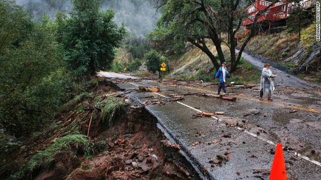
    Rescuer: We hoped for best in flood

    Man trapped in flooding, overturned car

    Mom and daughter stuck in hail, flood

    Deadly flooding in Colorado


    The rains sent virtually every waterway in Boulder County coursing out of its banks, and massive water flows washed away roads and bridges, flooded homes and stressed numerous other bridges.


    Three deaths had been reported: two in Boulder County and one in El Paso County. About 20 people have been reported missing by relatives in Boulder County, Sheriff's Cmdr. Heidi Prentup said.


    Lyons rescue

    The National Guard effort to get residents out of Lyons began shortly after daybreak. About 100 troops in 21 heavy vehicles able to ford high waters streamed into the city to begin moving residents out, Gov. John Hickenlooper said.


    Residents had been entirely cut off, without water or sewer service, in many cases without electricity, facing what Fire Chief J.J. Hoffman said in a Facebook posting was a "very large disaster."


    Not even National Guard helicopters -- grounded by poor weather -- could reach the residents Thursday.
    It was unclear when the evacuation would be complete.


    "I encourage all of you -- stay strong!" Hoffman wrote on the fire department's Facebook page. "We will make it through this, we are here for you and doing the absolute best we can with the resources we have to get to each and every one of you!"


    Lyons follows fellow Boulder County towns of Jamestown and Eldorado Springs to be evacuated as a result of the storm, which began around 6 p.m. Wednesday, Boulder County Sheriff Joe Pelle said.
    Up to another half inch of rain an hour is possible this afternoon, authorities said.


    While the forecast called for less rain Friday than the region had received the last few days, meteorologists warned that any rainfall would add to the flooding potential in the region, thanks to waterlogged ground unable to absorb any more water. A flash-flood warning remained in effect through noon.


    Danger elsewhere


    Overnight, flood sirens sounded in Boulder County as Colorado emergency officials feared that debris-caked canyonsmight give way and send another wall of water crashing through the city of Boulder and neighboring communities.


    "All residents are warned to go to higher ground immediately due to the potential for flash flooding along the creek," Boulder's Office of Emergency Management said.

    Emergency management warned that "there are mudslides at the mouth of Boulder Canyon 400 feet long and four feet deep as the sides of the canyon give way due to the saturation from the days-long rain."


    There were dramatic rescues Thursday, including a man pulled from an overturned car in rushing water on live television. But officials have had a difficult time reaching affected areas because of the flooding, debris, mudslides and washed-out roads.

    Emergency workers spent most of Thursday and night early Friday playing defense against rapidly rising water, Larimer County Sheriff Justin Smith said -- moving roadblocks farther and farther back as flooding spread.


    Rescue crews have yet to launch helicopters to aid in the rescue effort, Smith said. The helicopters have been grounded because of poor weather.
    HLNTV.com: 8 stunning Colorado flooding Twitter photos
    Boulder County takes a beating


    The worst of the damage reported Thursday was in Boulder County, where the National Weather Service said a 20-foot wall of water roared down a mountain canyon north of the city.


    One death was confirmed and another feared after a car stopped in the rushing water. Witnesses said a woman emerged from the car and was swept away. A man left the car and tried to reach her and also was overcome, said Prentup, the Boulder County Sheriff's Office commander. She said the man's body had been recovered and the woman was missing.


    Bodies also were found in a collapsed home in Jamestown and on a roadway in Colorado Springs.

    Elsewhere, homes collapsed onto residents and a dam in Larimer County broke, flooding some houses and trapping three people, a county spokesman said.

    Smith said some residents there face the dilemma of whether to try to move to safer shelters over bridges that may have been damaged. They will "have to use their own judgment," he said.


    An emergency message from the sheriff's office to residents of Big Thompson Canyon said, "If you are cut off because of a compromised bridge, you need to stay at your residence but have a plan to get to higher ground at a moment's notice."


    Dams threatened, roads washed away


    Dozens of roads were closed or impassable Friday in Boulder County alone.


    Between 25 and 30 roads were closed Thursday afternoon in Boulder County, Prentup said. Some of them had been washed out entirely.

    Officials have yet to determine the extent of the damage, but it will be severe, Hickenlooper said.

    "This is not going to get fixed in a week," he said. "We have lost a great deal of infrastructure."
    Last edited by American Patriot; September 13th, 2013 at 19:41.

  7. #27
    Expatriate American Patriot's Avatar
    Join Date
    Jul 2005
    Location
    A Banana Republic, Central America
    Posts
    48,612
    Thanks
    82
    Thanked 28 Times in 28 Posts

    Default Re: Weather Thread

    Incoming: Tropical Storm Karen (Edit: Not a hurricane yet)

    FEMA recalling workers ahead of Tropical Storm Karen; staff had been furloughed by shutdown


    By Associated Press,


    WASHINGTON — The White House says the Federal Emergency Management Agency is recalling some furloughed workers to help prepare for Tropical Storm Karen.
    White House spokesman Jay Carney says President Barack Obama is being updated about the storm. He says Obama directed his team to ensure staffing and resources are available to respond to the storm.


    Hundreds of thousands of federal workers have been furloughed by to the partial government shutdown. It’s unclear how many FEMA workers are being brought back.
    Tropical Storm Karen is the first named tropical system to menace the U.S. this year. A hurricane watch is in effect along the Gulf Coast.
    Last edited by American Patriot; October 3rd, 2013 at 18:12.

  8. #28
    Expatriate American Patriot's Avatar
    Join Date
    Jul 2005
    Location
    A Banana Republic, Central America
    Posts
    48,612
    Thanks
    82
    Thanked 28 Times in 28 Posts

    Default Re: Weather Thread

    Disaster officials warn New Orleans over Karen

    (AFP) – 10 minutes ago

    Miami — Authorities urged Gulf Coast residents Thursday to brace for a hit from Tropical Storm Karen, set to become the first named system to strike the United States this year.

    A hurricane watch was in effect from Grand Isle, Louisiana, eastward to Indian Pass, Florida, forecasters said.

    The city of New Orleans -- devastated by Hurricane Katrina in 2005 -- was under a tropical storm watch, according to the National Hurricane Center.

    "Gulf Coast residents in potentially impacted areas should take steps now to be prepared and follow the direction of local officials," said Craig Fugate, head of the Federal Emergency Management Agency.

    Households should stock up on essentials such as water, non-perishable food and medication, as well as cell phone chargers and extra batteries for radios and flashlights, FEMA said.

    Karen -- expected to be at or near hurricane strength on Friday -- could approach land within the hurricane watch area on Saturday, the Miami-based forecasters said.

    At 1500 GMT, Karen was about 485 miles (780 kilometers) south of the mouth of the Mississippi River, packing top winds of 65 miles per hour.

    The storm, situated in the southeastern part of the Gulf, was moving north-northwestward at 12 miles per hour.

    "A turn toward the north and a decrease in forward speed are expected during the next 48 hours," the NHC added.

    "Some additional strengthening is possible in the next day or so."

    With the storm approaching, FEMA said it had started recalling furloughed employees "necessary to serve functions of the agency that protect life and property."

    Due to a government shutdown sparked by a bitter budget impasse in Congress, some 800,000 federal workers from a wide swath of agencies were told to stay home earlier this week.

    Karen was expected to trigger heavy rains over parts of western Cuba and the northeastern Yucatan Peninsula over the next day or so.

  9. #29
    Expatriate American Patriot's Avatar
    Join Date
    Jul 2005
    Location
    A Banana Republic, Central America
    Posts
    48,612
    Thanks
    82
    Thanked 28 Times in 28 Posts

    Default Re: Weather Thread

    BS/AP/ October 3, 2013, 10:00 AM Tropical Storm Karen forms in the Gulf of Mexico; hurricane watch from La. to Fla.


    Tropical Storm Karen formed in the Gulf of Mexico on Oct. 3, 2013. / NASA


    NEW ORLEANS Preparations began Thursday along the central Gulf Coast as newly formed Tropical Storm Karen threatened to become the first named tropical system to menace the United States this year.
    Hurricane and tropical storm watches were posted from southeast Louisiana to Florida and some oil and gas platforms in the storm's projected path were being secured and evacuated.

    CBS News weather consultant David Bernard reports that Karen is expected to slow as it approaches the coast, increasing the likelihood of major rains along the Gulf Coast and across the Southeast through the weekend.

    The National Hurricane Center in Miami said Karen was about 485 miles south of the mouth of the Mississippi River and had maximum sustained winds of 65 mph.

    The hurricane watch was in effect from Grand Isle, La., to Indian Pass in the Florida Panhandle. A tropical storm watch also was in effect for parts of the Louisiana coast west of Grand Isle, including the New Orleans area.
    NOAA Storm Tracker: Atlantic


    Hurricane Tracking Sector (VIS) (NOAA)


    Karen was moving north-northwest at 12 mph. It could be at or near hurricane strength by Friday, forecasters said.


    While meteorologists said it was too soon to predict the storm's ultimate intensity, they said it could weaken a bit as it approaches the coast over the weekend.


    "Our forecast calls for it to be right around the border of a hurricane and a tropical storm," said David Zelinsky, a hurricane center meteorologist.


    Whether a weak hurricane or strong tropical storm, Karen's effects are expected to be largely the same: heavy rain and the potential for similar storm surge.


    Grand Isle Mayor David Camardelle, whose barrier island community about 60 miles south of New Orleans is often the first to order an evacuation in the face of a tropical weather system, said the town is making sure its 10 pump stations are ready. He is encouraging residents and clean out drainage culverts and ditches in anticipation of possible heavy rain and high tides.


    Otherwise, residents were monitoring the storm and hoping to dodge the foul weather.


    "Hopefully, this one is just a little rain event," said Camardelle "We don't need a big storm coming at us this late in the season."


    Zelinsky said residents in the warning areas should listen to their local emergency managers for advisories. "Now is the time to begin making preparations," Zelinsky said.


    Forecasters said a cold front approaching from the northwest was expected to turn Karen to the northeast, away from the Louisiana coast and more toward the Florida Panhandle or coastal Alabama. But the timing of the front's arrival over the weekend was uncertain.


    Grand Isle suffered damage from Hurricane Isaac in August 2012. Isaac clipped the mouth of the Mississippi River for its official first landfall before meandering northwest over Grand Isle and stalling inland. Though a weak hurricane, Isaac's stall built a surge along the southeast Louisiana coast that flooded communities in neighboring Plaquemines Parish.


    Mike Steele, a spokesman for the Louisiana Governor's Office of Homeland Security and Emergency Preparedness, said a conference call was planned Thursday morning for state and parish officials to discuss the storm.


    "Just so we can be in contact and see if there are any needs we can help meet," Steele said.


    Karen was expected to pass over Gulf oil and gas fields from Louisiana to Alabama, but early forecasts suggested the storm would miss the massive oil import facility at Port Fourchon, La., just west of Grand Isle, and the oil refineries that line the Mississippi River south of Baton Rouge.


    Oil giant BP said it has begun securing offshore rigs and evacuating non-essential workers from its four company-operated production platforms in Karen's projected path.

    Other oil companies were expected to take similar action.

  10. #30
    Expatriate American Patriot's Avatar
    Join Date
    Jul 2005
    Location
    A Banana Republic, Central America
    Posts
    48,612
    Thanks
    82
    Thanked 28 Times in 28 Posts

    Default Re: Weather Thread

    Looks like "Hurricane Karen" will hit the coast sometime this evening or late tonight.

    Also, this just in.... We're looking at chilly weather today. Cold front moved through late last night and temps dropped to the high 30s. Tonight in Colorado should be in the high 20s. Freeze warnings are out (or maybe watches, I forget now).

    Even so, it's going to get cold and we're looking at rain and possible snow this afternoon and evening.

    This morning it was raining like cats and dogs when I left for work - but not as bad as a few days ago with the floods.

    I'm beginning to think we're going to have a very long, shitty winter.

    Blizzard Eyes Areas From Wyoming to South Dakota

    By Courtney Spamer


    A storm capable of producing blizzard conditions is taking aim at portions of Wyoming, western South Dakota and northwestern Nebraska Friday.
    Dry, tranquil weather over the Central states now will not hold through the end of the week. The storm and its rapidly changing weather conditions may catch millions of people off guard.


    A storm responsible for bringing record rainfall to parts of the Northwest last weekend will blast areas from the Rockies to the Plains and Midwest with snow, wind, rain, severe thunderstorms and tornadoes into Saturday.


    @HenryMargusity: “Fall blizzard for parts of western South Dakota, Wyoming and western Nebraska. Over a foot of snow with winds over 40 mph.”Additional Relevant Tweets and Social Media Reaction

    Difficult travel is likely along much of I-80 and I-25 in Wyoming and I-90 in western South Dakota with snow- and slush-covered roads and poor visibility. Rapidly accumulating snow, blowing and drifting may cause some ill-prepared motorists to get stuck or become disoriented. The storm could be intense enough to close some roadways for a time.


    Wind gusts of 40 to 60 mph, both with and without heavy snow, can also down trees and power lines.


    Cities in the path of the storm and potential blizzard include Rapid City, S.D., Chadron, Neb., and Cheyenne and Casper, Wyo.


    A push of cold air from Canada colliding with warmth and moisture will bring snow to the northern Rockies and rain changing to snow, followed by blizzard conditions to some areas of the High Plains.


    Cold air will wrap in behind the reorganizing storm across Montana, Wyoming and northern Colorado. Strong winds and/or heavy snow will reach some areas hit by heavy snow last week and some locations hit by flooding earlier during September.


    The storm will strengthen greatly east of the Rockies Friday. As this happens, rain will become mixed with and change to snow in some locations of the High Plains.
    Blizzard conditions will center on the Black Hills of South Dakota. However, accumulating snow could reach as far to the east as central South Dakota and southeast into central Nebraska.


    Accumulating snow may reach just north and west of Denver, Colo. A slight shift in the storm track could bring accumulating snow to Denver.
    While it may be just a tad too warm for an all-out major snowstorm in areas farther east in Nebraska, the Dakotas and Minnesota, snow can mix in at times in these areas Friday night and Saturday.


    Across Colorado, some ski resorts are taking advantage of the cool weather and are already making snow. In preparation for the 2013-14 ski season, Loveland Ski Area and Arapahoe Basin Ski Area plan to make snow for as long as conditions allow, according to a press release by Colorado Ski Country USA (CSCUSA).


    RELATED: Winter/Severe Weather Watches and Warnings Tornado Threat Wisconsin to Oklahoma Eastern Wyoming/Western Nebraska Interactive Weather Radar
    Across southeastern Nebraska, Iowa and southern Wisconsin, the air will be too warm for snow, but powerful thunderstorms are a concern. Gusty winds will also be a factor.
    As high pressure builds in the wake of the storm over the West, a Santa Ana event could bring damaging winds and raise the risk of wildfires in Southern California late in the week.


    Temperatures will rebound and much of the snow at lower elevations will melt over the weekend.


    Expert Senior Meteorologist Alex Sosnowski contributed content to this story.AccuWeather


    By Courtney Spamer

  11. #31
    Super Moderator Malsua's Avatar
    Join Date
    Jul 2005
    Posts
    8,020
    Thanks
    2
    Thanked 19 Times in 18 Posts

    Default Re: Weather Thread

    Speaking of snow...I'm thinking about getting a snow blower to augment my snow removal operations.

    Guy in town has a 26" troy built for $450...one year old. Not fond of Troy built. I can only use a 2-stage.

    Any brands to avoid?
    "Far better it is to dare mighty things, to win glorious triumphs even though checkered by failure, than to rank with those poor spirits who neither enjoy nor suffer much because they live in the gray twilight that knows neither victory nor defeat."
    -- Theodore Roosevelt


  12. #32
    Expatriate American Patriot's Avatar
    Join Date
    Jul 2005
    Location
    A Banana Republic, Central America
    Posts
    48,612
    Thanks
    82
    Thanked 28 Times in 28 Posts

    Default Re: Weather Thread

    I live in Colorado. I use a snow shovel, a broom or my deck brushes..... keeps you in shape. Or dead if you're a weakling.

    LOL

    I have no idea about snow blowers myself. haha

  13. #33
    Expatriate American Patriot's Avatar
    Join Date
    Jul 2005
    Location
    A Banana Republic, Central America
    Posts
    48,612
    Thanks
    82
    Thanked 28 Times in 28 Posts

    Default Re: Weather Thread

    Tropical Storm Karen to Strike Upper Gulf Coast

    By Michael Doll


    Tropical Storm Karen has formed in the Gulf of Mexico and will move into the southern United States this weekend with heavy rain, gusty winds and rough seas.


    Karen will continue to move along a curved northward path over the central Gulf of Mexico through Friday. During Saturday, Karen will begin to turn toward the northeast.


    Landfall is expected along the upper Gulf Coast from southeast of New Orleans to west of Panama City, Fla., late Saturday night into early Sunday morning.


    There is a chance that Karen will become a hurricane prior to making landfall. Winds associated with Karen have reached 65 mph during its trek through the open Gulf waters. The threshold for a tropical system to become a hurricane is sustained winds of 74 mph.


    Karen is expected to make landfall as a tropical storm, however. Unfavorable winds aloft will prevent rapid strengthening and may slightly weaken the storm as it heads towards land. Hurricane-force gusts may still occur along the coast as it comes onshore.


    RELATED: 2013 Hurricane Season Ranks as One of the Least Intense AccuWeather.com Hurricane Center Wisconsin to Oklahoma: Powerhouse Storms, Tornadoes a Threat
    Near and just east of where Karen makes landfall, minor coastal flooding is possible. Wind gusts in the neighborhood of 65 mph can cause minor property damage, downed trees and power outages.


    Showers and thunderstorms will become more frequent from the Florida Panhandle to southeastern Louisiana Saturday.


    As Karen continues to head toward the coast, seas will gradually build over the central and eastern Gulf of Mexico.


    As seas build, the frequency and strength of rip currents will increase along with the possibility of beach erosion.


    Rainfall can be heavy enough to alleviate recent dry conditions in some locations of the South. However, the rain may raise the risk of flooding for parts of the region, not only near the Gulf Coast, but also inland as the storm moves northeastward over the interior South.


    A pocket of 3- to 6-inch rainfall can occur close to the center of the storm track, inland as far as the southern Appalachians and Piedmont.


    Sometimes as tropical systems make landfall, tornadoes can be produced.


    According to AccuWeather.com Hurricane Expert Dan Kottlowski, “Tornadoes are a possibility, north and east of the landfall Saturday into Sunday morning, focusing on the Florida Panhandle, but perhaps a far west as southern Alabama and southeastern Mississippi.”


    AccuWeather.com meteorologists have been tracking Karen all week.


    Karen first started as a cluster of showers and thunderstorms across the southern and central Caribbean. Disruptive winds kept development to a minimum but as the disturbance moved into the Gulf, warmer waters and less land interaction allowed some strengthening to occur.
    Winds aloft still remain unfavorable which has kept Karen from rapidly intensifying.


    Other storm systems across the United States will dictate where Karen and its associated moisture heads after landfall.


    This weekend over the mainland United States, a strong cold front will first move across the Mississippi Valley.


    This will help pull the moisture from this Gulf of Mexico system northward and enhance rainfall from the Gulf Coast to part of the interior South.


    The aforementioned cold front will eventually bring showers and some thunderstorms to the mid-Atlantic and Northeast late on Sunday into Monday.


    There is a chance that moisture from Karen enhances the rainfall across parts of the mid-Atlantic and and perhaps New England early next week, where the rain is most needed and the weather of late has been more like summer rather than autumn. - AccuWeather


    Content contributed by Alex Sosnowski, expert senior meteorologist.
    Related articles


  14. #34
    Creepy Ass Cracka & Site Owner Ryan Ruck's Avatar
    Join Date
    Jul 2005
    Location
    Cincinnati, OH
    Posts
    25,061
    Thanks
    52
    Thanked 78 Times in 76 Posts

    Default Re: Weather Thread

    Quote Originally Posted by Malsua View Post
    Speaking of snow...I'm thinking about getting a snow blower to augment my snow removal operations.

    Guy in town has a 26" troy built for $450...one year old. Not fond of Troy built. I can only use a 2-stage.

    Any brands to avoid?
    Troy-Bilt is an MTD brand so finding parts should be easy.

    My friend that owns a landscape business and does snow removal uses Cub Cadet, which is also MTD owned.

  15. #35
    Literary Wanderer
    Join Date
    Jun 2006
    Location
    Colorado
    Posts
    1,590
    Thanks
    5
    Thanked 6 Times in 6 Posts

    Default Re: Weather Thread

    Ariens seems to be one of the best two-stage blowers out there. Sorry, you wanted brands to avoid. I would say it all depends on how serious you are about your equipment. What might be adequate or acceptable for some homeowners, may be an unreliable pile of parts over time.

    Quote Originally Posted by Malsua View Post
    Speaking of snow...I'm thinking about getting a snow blower to augment my snow removal operations.

    Guy in town has a 26" troy built for $450...one year old. Not fond of Troy built. I can only use a 2-stage.

    Any brands to avoid?
    Last edited by MinutemanCO; October 4th, 2013 at 18:05.

  16. #36
    Expatriate American Patriot's Avatar
    Join Date
    Jul 2005
    Location
    A Banana Republic, Central America
    Posts
    48,612
    Thanks
    82
    Thanked 28 Times in 28 Posts

    Default Re: Weather Thread

    Hey MMCO! What's the weather doing up there right now?

    Wife said the clouds were closing in as she was headed up the mountain.... We had snow East of us about 25 miles (heavy) this morning. It's been sunny since about 7:30 here I think (not that I can see crap from the bowels of planet right now).

  17. #37
    Literary Wanderer
    Join Date
    Jun 2006
    Location
    Colorado
    Posts
    1,590
    Thanks
    5
    Thanked 6 Times in 6 Posts

    Default Re: Weather Thread

    It's been overcast and dreary all day. We got some rain/snow mix this morning, covered the ground.

  18. #38
    Expatriate American Patriot's Avatar
    Join Date
    Jul 2005
    Location
    A Banana Republic, Central America
    Posts
    48,612
    Thanks
    82
    Thanked 28 Times in 28 Posts

    Default Re: Weather Thread

    Was still sunny here (and is now). Chilly though... mid 40s probably. Windy as hell though.

  19. #39
    Expatriate American Patriot's Avatar
    Join Date
    Jul 2005
    Location
    A Banana Republic, Central America
    Posts
    48,612
    Thanks
    82
    Thanked 28 Times in 28 Posts

    Default Re: Weather Thread

    Hey Ryan, how's that 30 degree freezing rain you're getting doing?

    Looks like the storms are hitting you now from the maps.

  20. #40
    Creepy Ass Cracka & Site Owner Ryan Ruck's Avatar
    Join Date
    Jul 2005
    Location
    Cincinnati, OH
    Posts
    25,061
    Thanks
    52
    Thanked 78 Times in 76 Posts

    Default Re: Weather Thread

    Last night they had said we were supposed to be transitioning over to snow mid morning. Some areas north and west had already started to transition last night.

    I woke up an hour ago to nothing!

    Interestingly, though, the NWS has upped their predicted storm totals. They're now saying transitioning to snow in the next couple hours. With their totals upped, they must be expecting us to get dumped on when it does start!

Thread Information

Users Browsing this Thread

There are currently 27 users browsing this thread. (0 members and 27 guests)

Similar Threads

  1. Decoding Weather Satellites
    By AGEUSAF in forum Amateur Radio
    Replies: 18
    Last Post: January 3rd, 2014, 03:14
  2. Severe Weather Outbreak - 4/14/2012
    By Ryan Ruck in forum General Topics
    Replies: 5
    Last Post: April 14th, 2012, 21:03
  3. Severe Weather Outbreak - 3/2/2012
    By Ryan Ruck in forum General Topics
    Replies: 70
    Last Post: April 4th, 2012, 04:44
  4. Space Weather, Communications
    By American Patriot in forum Space
    Replies: 0
    Last Post: April 5th, 2007, 16:56
  5. Space Weather Advisory Bulletin #06- 5
    By American Patriot in forum Space
    Replies: 2
    Last Post: December 14th, 2006, 22:22

Bookmarks

Posting Permissions

  • You may not post new threads
  • You may not post replies
  • You may not post attachments
  • You may not edit your posts
  •